Severe weather can strike with little warning, causing significant damage to crops, buildings, and infrastructure. While we cannot prevent storms, we can prepare for them — and the better our forecasting tools, the more time we have to act.
In this article, we explore how weather forecasts work, why storms are so difficult to predict, and what practical steps you can take to protect your farm and property when a storm is on the way.
Country and regional weather forecasts
Weather forecasts are produced at different scales. National forecasts provide a general overview of expected conditions across the entire country — useful for planning a few days ahead, but too broad to capture local variations.
Regional and local forecasts offer much greater detail. They take into account terrain features, proximity to water bodies, and local climate patterns to deliver predictions that are far more relevant to your specific location. For farmers, regional forecasts are essential for scheduling fieldwork, irrigation, and harvest.
How accurate are weather forecasts?
Modern numerical weather prediction models have improved dramatically over the past decades. Short-range forecasts (1–3 days ahead) are highly reliable, with accuracy rates often exceeding 80–90% for temperature and general conditions.
Medium-range forecasts (4–7 days) are still useful but become progressively less precise. Beyond 7–10 days, forecasts provide only broad trends rather than specific predictions.
For agricultural decision-making, the most actionable forecasts are those covering the next 24–72 hours.
Why is 100% forecast accuracy impossible?
The atmosphere is a chaotic system — tiny differences in initial conditions can lead to vastly different outcomes over time. This is sometimes called the butterfly effect.
Weather models rely on data from thousands of observation stations, weather balloons, satellites, and radar systems. Despite this vast network, there are always gaps in the data, and every measurement carries a small margin of error. These uncertainties multiply as the forecast extends further into the future.
This is why meteorologists use ensemble forecasting — running the same model many times with slightly different starting conditions to produce a range of possible outcomes and their probabilities, rather than a single deterministic prediction.
Storms — how far in advance can we predict them?
Storms are among the most difficult weather events to forecast precisely. While large-scale atmospheric patterns that favor storm development can be identified 1–3 days in advance, the exact location, timing, and intensity of individual storm cells can typically only be predicted a few hours before they occur.
This is because thunderstorms form through a rapid chain of events — warm, moist air rises quickly, condensation releases energy, and the storm cell develops and matures within just 30–60 minutes. The smaller the scale of the phenomenon, the harder it is to predict.
Storm radar as a source of real-time information
When a storm is approaching, weather radar becomes the most valuable tool. Storm radars detect precipitation in real time by sending out pulses of microwave energy and measuring the signals that bounce back from raindrops, hail, and other particles in the atmosphere.
Modern Doppler radars can also measure the speed and direction of precipitation movement, making it possible to estimate where the storm is heading and how fast it is moving. Radar data is updated every few minutes, giving you a near-real-time picture of what is happening in the sky.
Check where the storm is right now
Today, anyone with a smartphone or computer can access live storm radar maps and real-time lightning detection networks. These tools show the current position of storm cells, the intensity of precipitation, and the location of lightning strikes as they happen.
Popular storm tracking services overlay radar data, lightning data, and satellite imagery on a single map, making it easy to see whether a storm is approaching your area. Many apps also send push notifications when severe weather is detected within a certain radius of your location.
The likely direction of front movement
Understanding the general direction of storm movement can help you estimate when it will reach your area. In Central Europe, weather fronts and storm systems most commonly travel from west to east or from southwest to northeast, driven by the prevailing westerly winds.
However, local topography, sea breezes, and interactions between air masses can alter this pattern. Checking radar animations — which show how the storm has moved over the past hour — is the most reliable way to estimate its trajectory and speed.
Protect your property before the storm
When a storm warning is issued, there are several practical steps you can take to minimize damage:
- Secure loose objects — bring in or tie down anything that could be picked up by strong winds: garden furniture, tools, tarpaulins, containers, and lightweight structures.
- Close windows and doors — make sure all openings in buildings, greenhouses, and storage facilities are shut and latched.
- Park vehicles under cover — if possible, move cars, tractors, and other machinery into garages or under solid shelters to protect them from hail.
- Disconnect sensitive electronics — unplug devices that could be damaged by power surges caused by lightning strikes.
- Stay informed — keep monitoring radar maps and official weather warnings so you know when the storm is expected to pass and when it is safe to resume outdoor activities.
- Have an emergency plan — make sure everyone on the farm knows where to take shelter and what to do if conditions deteriorate rapidly.
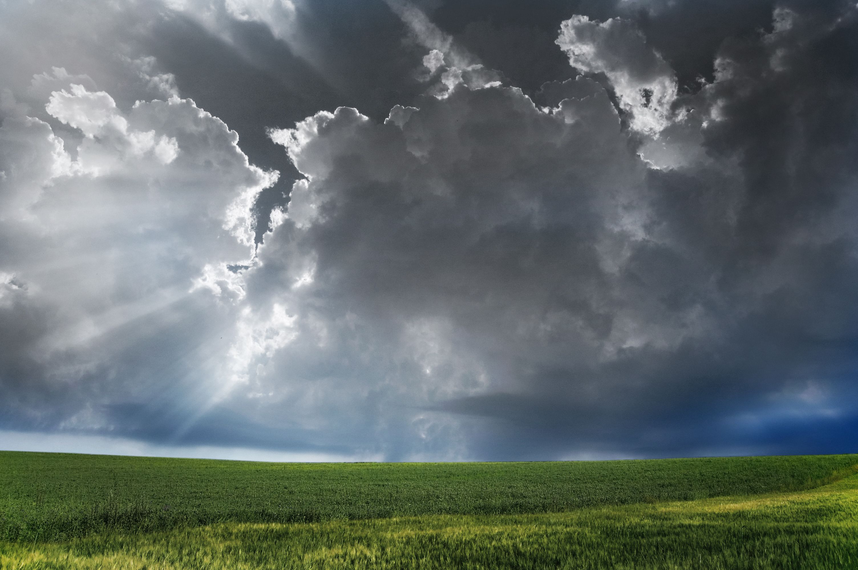
What is a storm and when can it form?
A thunderstorm is an atmospheric phenomenon characterized by lightning, thunder, heavy rainfall, and often strong wind gusts or hail. Storms form when three conditions are met simultaneously:
- Moisture — sufficient water vapor in the lower atmosphere provides the fuel for cloud development.
- Instability — warm air near the surface rises rapidly through cooler air aloft, creating powerful updrafts that build towering cumulonimbus clouds.
- A lifting mechanism — a weather front, terrain feature, or localized heating triggers the initial upward movement of air.
In Central Europe, storms are most common from May to September, with peak activity in June and July. However, in an era of changing climate patterns, severe storms can occur outside this traditional window as well.
Analysis of current European weather patterns
Understanding the broader synoptic situation across Europe helps put local forecasts in context. Meteorologists analyze pressure systems, jet stream position, and air mass boundaries to assess where conditions are most favorable for storm development.
When a deep low-pressure system moves across Western Europe and warm, moist air from the Mediterranean collides with cooler Atlantic air, the result is often a broad area of thunderstorm activity stretching across Central Europe. Keeping an eye on these large-scale patterns — through synoptic weather maps or forecast discussions — gives you an early heads-up days before storms actually form.
Climate warming and severe storms
Scientific evidence increasingly shows that climate change is influencing the frequency and intensity of severe weather events, including thunderstorms. A warmer atmosphere holds more moisture, which means that when storms do form, they can produce heavier rainfall, larger hail, and stronger wind gusts than in the past.
Studies suggest that while the total number of thunderstorm days may not increase dramatically, the proportion of severe and extreme storms is rising. For farmers, this means that investing in weather monitoring tools, crop insurance, and resilient infrastructure is more important than ever.
Storm chasers — tracking severe weather up close
Storm chasing is the practice of pursuing severe thunderstorms, tornadoes, and other extreme weather events in order to observe, photograph, and study them. While often associated with the Great Plains of the United States, storm chasing also takes place in Europe.
Professional storm chasers contribute valuable ground-truth data that complements radar and satellite observations. Their reports help meteorologists verify and improve forecast models. However, storm chasing is inherently dangerous and should only be attempted by trained individuals with proper safety equipment and a thorough understanding of storm behavior.
For the rest of us, the safest way to experience the power of storms is through real-time radar maps, live streams, and the stunning imagery that storm chasers share with the public.
Summary
Storms are sudden weather phenomena that can only be precisely forecast a few hours before they occur. Storm radars and real-time lightning maps allow tracking the front's movement and preparing for dangerous conditions.